
 |
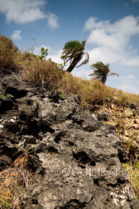
| Corals, blue sky and Vuyavoy palms |
As it turned out, the wind shifted from 8 to 32 miles per hour on our first night on Batan. That speaks volumes on how temperamental the weather can be, shifting from calm one day to blustery the next. That also put a big question mark on our plans to cross over to Itbayat, over 21 nautical miles away, the next day. With hesitation (or was it trepidation?), we came up with an alternative itinerary to explore more of Batan but went to sleep still praying and dreaming of proceeding to the coral island and completing our 3-island hop on our second day in Batanes.
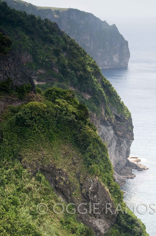 |
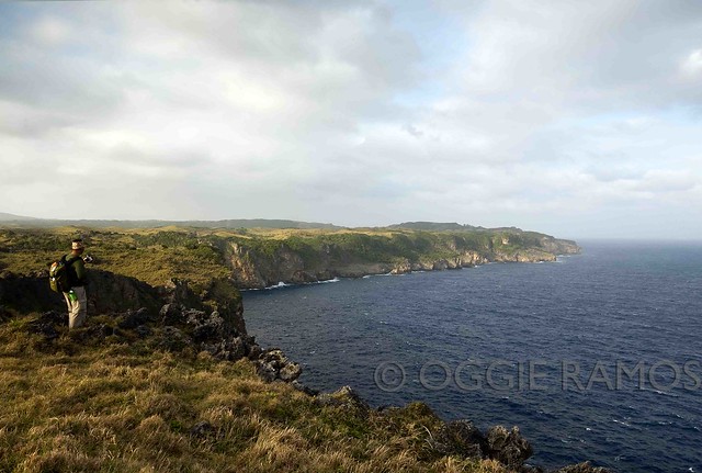
| The view up the cliff of Mauyen Port |
We woke up to an overcast morning, quickly noticing that the wind has slowed down considerably. Up to the point when we headed to the Basco port, we were unsure if the Itransa boat will be allowed to sail. Still, that didn't keep hordes of locals from trying their luck, most of whom are Itbayat residents coming home for the Holy Week. One benefit of the life vests we were required to wear was that it's now easier to spot how many passengers there are. Well, we spotted a lot.
It was a full house on the boat as the other transport, the M/V Misubi, which does not ply the Basco-Itbayat route regularly anyway, was not sailing. There was just enough space to sit upright and the first few minutes sailing out of the Basco port was ominous as we rode out waves taller than our boat. Joaquin, our guide, had the good idea of getting me to stand up at the back of the boat early on as looking out to the sea, interestingly, made me less queasy than sitting down in the cramped quarters. "The ride may smoothen out as we make it far out to sea," Joaquin told me in Filipino. But more than an hour into the journey, the boat still kept pitching, dancing and swaying wildly to the rhythm of a tempestuous, agitated sea -- a fact that didn't escape some locals who gave in to the urge to give back their breakfast to the sea.
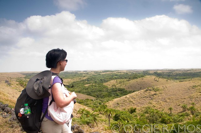 |
| Admiring the beautiful landscape after a rough ride |
Un-Bonamine me. Towards the second hour with the silhouette of the island of D'nem in sight, we got news that we will not be boarding off the usual port, Chinapoliran, which was still an hour away, being 25 nautical miles from Basco. Instead, we were disembarking at Mauyen on the southern part of Itbayat. Mercifully, that meant being spared from another hour of Bonamine-resistant seasickness (Honestly, I thought I would need that barf bag if we sailed another hour). Nevermind that using Mauyen port meant hiking 14 zigzag paths up a towering cliff to get a truck ride to Mayan town which is 14 kilometers away. Seeing the lay of Raele was an instant salve for seasickness -- rolling terrain of grasses dancing in the breeze and windswept Vuyavoy trees littering the landscape as far as my eyes can see.
We met Nanay Faustina Cano again as we are staying overnight at her place. Her homestay is a far cry from before, now with a separate wing for men's accommodations at the back and an outdoor eating place under the mango tree. Her warm welcome contrasted with the nippy air, far removed from dry and humid Batan due to the prevailing habagat (southwest monsoon) and the island's higher lattitude. Another welcome thing we'd remember for the rest of the trip was the store in front that carried a wide assortment of snacks including Oishi chocolate popcorn and Baked Porky Pops. (The first was rather unexpected as I am having difficulty finding it here in Manila. Makes you wonder how far these commodities had to travel to get here. Another suprise: they're sold at prices cheaper than 7Eleven's and MiniStop's in Manila)
 |
| Beautiful and massive Torongan Cave |
Going caving. Now we get to do what we missed out during my first time in Itbayat -- going to Torongan Cave on the western coast. We rode the dump truck about an hour to get to the jump-off, hiked for almost an hour through the forest to get to this ancient dwelling place of Austronesians from Taiwan who migrated here 4,000 years ago. The Austronesians are a seafaring people who invented the outrigger. This is a curious fact since the Ivatan fishermen have long abandoned the outrigger (katig in Filipino) in favor of the flat-bottom boat called falowa (called Tataya in Itbayaten) since the waves here I'm told render the katig useless or even perilous. The cave is an an awe-inspiring architecture of nature, stalactites and stalagmites crowding the maw and calls to mind chandeliers of a huge cathedral.
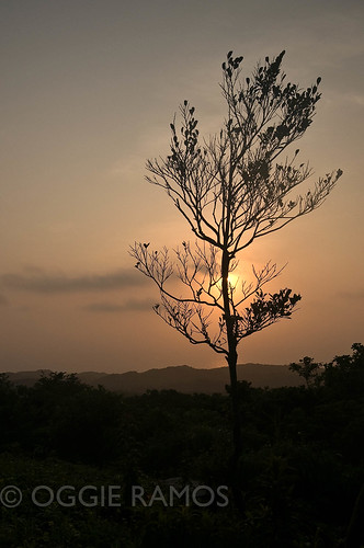
Going inside, there's a draft from the wind coming from the opening in the cliff that looks out to the sea. I can't help but imagine how the early dwellers must have felt living in this mostly dark, cavernous place, with the sound of the sea unceasingly reverberating inside. Towards sunset, we climbed out and up to see the ancient burial site on top of the hill -- graves marked by stones arranged to resemble boats, perhaps to honor the Austronesians' seafaring ancestors. The view from the top, especially in the golden hours of sunset, is simply breathtaking. Here, as with a lot of places in Batanes, I feel I can spend the whole day just watching the clouds, the waves, the day go by.
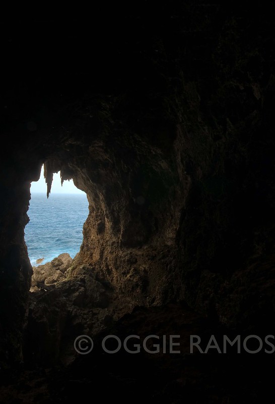 |
| Torongan Cave opens up to the sea on the western side |
 |
| Admiring the lay of the land atop Torongan |
 Trivia: Itbayat is one of the largest uplifted corral islands in the world. According to Wikipedia, a coral island is an island that forms a ring and partially or totally encloses a shallow body of water or lagoon. It is formed by a build-up of depositing lava on top of lava from a volcano that rises up out of the sea. The coral island dies when the volcano becomes inactive and sinks. The formation is a hard rock like material formed by the skeleton of marine polyps and sand. Most of the coral islands are located in the Pacific Ocean.
Next on Lagalog: Waking up with the sun in Karaboboan